
Anúncios
Explore the World Through Satellite Imagery
Launch Your Journey
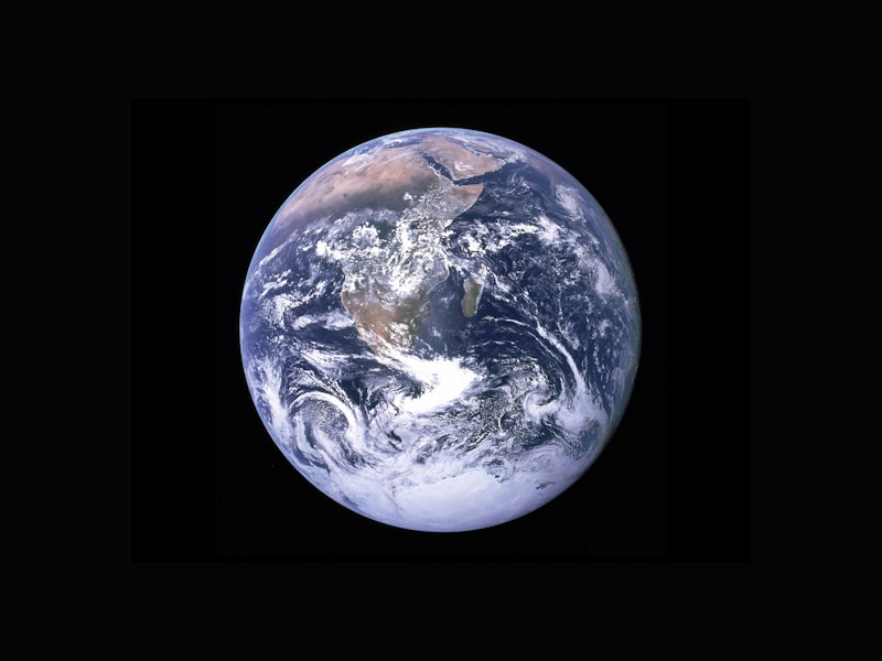
The ability to view cities from space has transformed from a privilege reserved for space agencies and military operations into an accessible reality for anyone with a smartphone or computer. Satellite imagery applications have revolutionized how we explore, navigate, and understand our planet, offering breathtaking perspectives of urban landscapes, natural wonders, and remote locations that most people will never physically visit.
These powerful tools combine cutting-edge satellite technology with intuitive interfaces, allowing users to zoom from a global view down to street-level detail in seconds. Whether you’re planning a vacation, studying geography, conducting research, or simply satisfying your curiosity about distant places, satellite imagery apps have become indispensable companions in our increasingly connected world. 🌍
Anúncios
The Evolution of Satellite Imagery Technology
The journey of satellite imagery began in the 1960s with basic reconnaissance satellites capturing grainy black-and-white photographs. Today’s technology represents a quantum leap forward, with commercial satellites capturing images with resolution sharp enough to identify individual vehicles and building features. This transformation has democratized access to information that was once classified and restricted.
Modern satellite imagery applications leverage data from multiple sources, including government satellites, commercial imaging companies, and aerial photography. The integration of these various data streams creates comprehensive, regularly updated views of Earth’s surface. Companies like Maxar, Planet Labs, and Airbus Defense and Space continuously launch new satellites with improved sensors, ensuring that the imagery becomes more detailed and current with each passing year.
Anúncios
The processing power required to handle petabytes of satellite data has also evolved dramatically. Cloud computing infrastructure enables these applications to deliver high-resolution imagery to millions of users simultaneously without significant lag or degradation in quality. Machine learning algorithms now automatically stitch together thousands of individual satellite photos, remove cloud cover, and enhance clarity to create seamless global maps.
Leading Applications for Exploring Cities via Satellite 🛰️
The market offers numerous applications designed specifically for viewing satellite imagery, each with unique features and strengths. Understanding the landscape of available tools helps users select the platform best suited to their specific needs and interests.
Google Earth: The Pioneer and Industry Standard
Google Earth remains the most recognized name in satellite imagery viewing, and for good reason. The platform combines satellite photos, aerial photography, and GIS data to create an incredibly detailed three-dimensional representation of Earth. Users can explore virtually any location on the planet, from the peaks of Mount Everest to the streets of Tokyo.
The application features a “Voyager” section that offers curated tours of interesting locations, historical sites, and natural wonders. The time-lapse feature allows users to see how cities and landscapes have changed over decades, revealing urban sprawl, environmental changes, and infrastructure development. This historical perspective adds educational value that goes beyond simple viewing.
Google Earth’s 3D buildings feature transforms major cities into explorable virtual environments. Users can fly through Manhattan’s skyscraper corridors or circle the Eiffel Tower from any angle. The integration with Street View creates a seamless transition from satellite perspective to ground-level exploration, offering multiple viewpoints of the same location.
NASA Worldview: Scientific Precision Meets Public Access
For those interested in a more scientific approach to satellite imagery, NASA Worldview provides near-real-time access to satellite data from NASA’s fleet of Earth-observing satellites. Unlike consumer-focused applications, Worldview emphasizes environmental monitoring, weather patterns, and natural phenomena.
The platform excels at displaying specialized data layers, including sea surface temperatures, air quality indices, vegetation health, and natural disasters in progress. Researchers, educators, and environmental enthusiasts find particular value in the ability to compare different spectral bands and temporal sequences that reveal patterns invisible to standard photography.
Zoom Earth: Real-Time Weather and Satellite Views
Zoom Earth specializes in current satellite imagery, updating its maps every 10 minutes with the latest available data. This makes it particularly valuable for tracking weather systems, monitoring wildfires, and observing atmospheric conditions as they develop. The application’s clean interface focuses on delivering the most recent imagery without overwhelming users with complex features.
Storm trackers and weather enthusiasts appreciate Zoom Earth’s ability to display infrared satellite views alongside visible light imagery. The time slider allows users to create animations showing cloud movement, storm development, and weather pattern evolution over recent hours and days.
Practical Applications Beyond Curiosity 🔍
While exploring cities from space offers inherent entertainment value, satellite imagery applications serve numerous practical purposes that impact various professional fields and personal activities.
Urban Planning and Real Estate Analysis
City planners and real estate professionals increasingly rely on satellite imagery to assess property values, analyze neighborhood characteristics, and identify development opportunities. The bird’s-eye perspective reveals spatial relationships, transportation access, and environmental features that ground-level views might miss.
Potential home buyers use these applications to evaluate neighborhoods before visiting, examining proximity to amenities, traffic patterns, and nearby land uses. The ability to measure distances and areas directly within many applications provides quantitative data to support decision-making.
Travel Planning and Destination Research
Travelers use satellite imagery apps to preview destinations, identify points of interest, and plan itineraries with geographic context. Seeing the actual layout of a city helps visitors understand the relationship between attractions, estimate walking distances, and choose accommodation in ideal locations.
Adventure travelers exploring remote regions particularly benefit from satellite views that reveal terrain characteristics, water sources, and access routes. This information enhances safety and helps set realistic expectations about the challenges of reaching isolated destinations.
Education and Geographic Literacy
Educators have embraced satellite imagery as a powerful teaching tool that brings geography lessons to life. Students can explore ecosystems, compare urban and rural environments, and observe geographic features discussed in textbooks within their actual global context.
The ability to measure distances, calculate areas, and observe relationships between human settlements and natural features transforms abstract concepts into concrete visual experiences. This hands-on exploration deepens understanding and retention compared to traditional map-based instruction.
Technical Features That Enhance the Experience 📱
Modern satellite imagery applications incorporate sophisticated features that extend functionality far beyond simple viewing. Understanding these capabilities helps users extract maximum value from these powerful tools.
3D Terrain Visualization
Most advanced applications render terrain elevation data alongside satellite imagery, creating three-dimensional landscapes that reveal the vertical dimension of geography. Mountain ranges, valleys, and coastal topography become dramatically apparent when viewed with elevation data enabled.
Users can adjust viewing angles and perspectives, simulating flight over terrain or examining features from ground-level vantage points. This capability proves particularly valuable for hikers, climbers, and outdoor enthusiasts planning expeditions in unfamiliar territory.
Historical Imagery Comparison
The time-travel features available in applications like Google Earth allow users to select images from different dates, sometimes spanning several decades. This temporal analysis reveals urban expansion, environmental degradation, infrastructure development, and the impact of natural disasters.
Researchers studying climate change, deforestation, glacier retreat, and coastal erosion find this historical perspective invaluable for documenting and quantifying environmental changes over time.
Measurement and Annotation Tools
Built-in measurement capabilities allow users to calculate distances, perimeters, and areas directly on satellite imagery. These tools support activities ranging from property assessment to hiking route planning. Some applications include elevation profile features that display terrain cross-sections along selected paths.
Annotation features enable users to mark locations, add notes, and create custom maps with personalized information. Saved places and custom tours can be shared with others or referenced during actual visits to locations.
Privacy Considerations and Limitations ⚖️
While satellite imagery applications offer remarkable capabilities, users should understand both the privacy implications and technical limitations of these technologies.
Image Resolution and Update Frequency
Although satellite imagery continues to improve, resolution varies significantly by location. Major cities typically receive high-resolution coverage with frequent updates, while rural and remote areas may have older imagery with lower detail levels. Users should check image dates when making decisions based on satellite views, as significant changes may have occurred since the most recent imagery was captured.
The time lag between image capture and public availability means that satellite imagery applications don’t provide true real-time views despite the impression of currency. Weather conditions, satellite orbits, and processing requirements all introduce delays ranging from days to months.
Privacy and Security Issues
The availability of detailed satellite imagery raises legitimate privacy concerns. While most consumer applications automatically blur or degrade resolution for sensitive facilities and private spaces, the overall level of detail available to the public represents a significant change from earlier eras when such information required special access.
Individuals concerned about privacy should understand that satellite imagery captures outdoor spaces visible from public vantage points. The same legal principles that allow photography from public spaces generally apply to satellite imagery, though specific regulations vary by jurisdiction.
The Future of Satellite Imagery Applications 🚀
Emerging technologies promise to further enhance satellite imagery applications, expanding capabilities and improving the user experience in coming years.
Artificial Intelligence and Image Enhancement
Machine learning algorithms are increasingly used to enhance satellite imagery, remove atmospheric interference, and even predict what areas look like when cloud cover prevents clear optical imaging. AI-powered systems can automatically identify changes between images, flag areas of interest, and generate alerts for specific events or conditions.
Future applications may incorporate AI assistants that respond to natural language queries, automatically finding and displaying locations based on descriptive requests rather than requiring precise geographic coordinates or place names.
Increased Resolution and Update Frequency
The next generation of commercial imaging satellites promises sub-meter resolution capable of distinguishing objects smaller than one meter across. Combined with larger satellite constellations, this technology will enable near-daily updates of any location on Earth, creating a nearly real-time view of the planet’s surface.
Some companies are developing systems that combine satellite imagery with drone photography and ground-based sensors, creating hybrid mapping systems with unprecedented detail and currency.
Augmented Reality Integration
The convergence of satellite imagery with augmented reality technology will allow users to overlay satellite views onto their real-world environment through smartphone cameras. This integration will create intuitive navigation systems, educational experiences that blend physical and digital information, and gaming applications that use real-world geography as the playing field.
Getting Started With Satellite Imagery Exploration 🌐
For newcomers to satellite imagery applications, beginning the exploration journey requires minimal technical knowledge but benefits from understanding a few basic principles and techniques.
Choosing the Right Application
Start by identifying your primary purpose for using satellite imagery. Casual exploration and travel planning work well with consumer-friendly applications like Google Earth. Scientific research or environmental monitoring may require specialized platforms like NASA Worldview or Sentinel Hub that provide access to specific data types and spectral bands.
Most satellite imagery applications offer both web-based versions accessible through browsers and dedicated mobile apps for iOS and Android devices. The web versions typically provide more features and better performance for detailed exploration, while mobile apps excel at portability and location-based discovery.
Navigation Techniques and Tips
Effective navigation within satellite imagery applications combines search functions with manual exploration. Begin by searching for familiar locations to understand the interface and available detail levels. Experiment with zoom controls, viewing angle adjustments, and layer toggles to discover the full range of available features.
Pay attention to the image date displayed for each view, as this information provides context for what you’re observing. Use historical imagery features to compare current views with past conditions, revealing changes and developments over time.
Enhancing Your Experience
Take advantage of curated content and suggested tours available in most applications. These guided experiences highlight interesting locations, explain geographic phenomena, and demonstrate advanced features you might not discover independently.
Consider joining online communities focused on satellite imagery exploration. Enthusiasts share interesting discoveries, technical tips, and creative uses for these applications. These communities often organize challenges and collaborative projects that add social dimensions to what might otherwise be a solitary activity.
Maximizing the Educational Value 📚
Satellite imagery applications represent powerful educational resources that bring abstract geographic concepts to life through direct visual experience. Educators and students can leverage these tools to enhance learning across multiple subjects and grade levels.
Create comparative studies examining different cities, ecosystems, or geographic features. Students can analyze urban planning differences between cities on different continents, compare agricultural practices in various climate zones, or observe how different cultures adapt to challenging environments.
Use measurement tools to calculate real-world distances, areas, and elevations, connecting mathematical concepts to tangible geographic features. Students gain appreciation for scale, proportion, and spatial relationships through hands-on exploration rather than abstract problem sets.
Document environmental changes by comparing historical imagery from different time periods. Students can observe deforestation, urban expansion, glacier retreat, and coastal erosion, developing awareness of human impact on the environment through visual evidence rather than statistics alone.
Beyond Earth: Exploring Other Worlds 🪐
Several satellite imagery applications have expanded beyond Earth to include views of the Moon, Mars, and other celestial bodies. These features allow armchair astronauts to explore alien landscapes with the same ease as viewing cities on Earth.
Google Earth includes Moon and Mars viewing modes that incorporate imagery from NASA missions. Users can explore landing sites from Apollo missions, examine Martian volcanoes and canyons, and discover features named after scientists and explorers.
These extraterrestrial viewing capabilities provide educational opportunities for astronomy students and space enthusiasts. Comparing landscapes on different worlds highlights the unique characteristics of Earth while revealing the diversity of environments within our solar system.

Professional Applications and Advanced Uses 💼
Beyond consumer applications, satellite imagery supports numerous professional fields with specialized requirements and workflows. Understanding these advanced applications reveals the full scope of this technology’s impact.
Emergency response teams use satellite imagery to assess disaster damage, plan rescue operations, and coordinate relief efforts. The ability to quickly survey large affected areas helps allocate resources efficiently and identify communities in greatest need.
Agricultural professionals monitor crop health, assess irrigation effectiveness, and estimate yields using specialized satellite data that captures information beyond the visible light spectrum. These applications help optimize farming practices and predict harvests.
Environmental conservation organizations track habitat loss, monitor protected areas for illegal activities, and document ecosystem health through regular satellite observation. This remote monitoring enables effective stewardship of vast territories that would be impossible to patrol on the ground.
The accessibility of satellite imagery has transformed how we understand and interact with our planet. What began as military and scientific technology has evolved into tools that anyone can use to explore, learn, and make informed decisions. As technology continues advancing, these applications will become even more powerful, detailed, and integrated into our daily lives. Whether you’re planning a vacation, conducting research, or simply satisfying your curiosity about distant places, satellite imagery applications offer a window to the world that previous generations could never have imagined. The planet awaits your exploration—all from the comfort of your screen. ✨